

RB Drones
RB Drones is a company that provides high-quality aerial imagery and data for various industries and purposes. Using drones or unmanned aerial vehicles (UAVs), we can capture stunning aerial videos and photos, as well as perform drone inspections, drone mapping, and drone data analysis. We are insured and FAA certified pilots who can handle many projects, from residential real estate photography to LiDAR services. Whether you need to showcase your property, monitor your construction site, assess your emergency situation, or optimize your agricultural yield, RB Drones can help you achieve your goals with fast turnaround and affordable prices.
Drones: The Power of Aerial Technology
How Drones Fuel our Passion for Aerial Imagery and Data Services
We are passionate for drones and their amazing capabilities to capture images and data for various services. Drones allow us to explore the world from a different perspective, whether it’s flying through the forest, racing with other pilots, or documenting a project. We strongly believe that drones are not just toys, they are powerful tools that can help with many tasks and challenges. we love learning new skills and techniques with drones, and we enjoy sharing our passion with others.
How to Use Aerial Technology for Various Needs
-

Construction Site
Drone construction inspection is using drones to check assets that are hard to reach by humans. They can do different kinds of inspections and save time, money, and risk. They can also show real-time data and 3D maps of sites.
-

Bridges
Bridge inspection using drones is a method of using UAVs to collect images and data of bridges. It can save costs, time, and risks and improve inspection quality and accuracy.
-
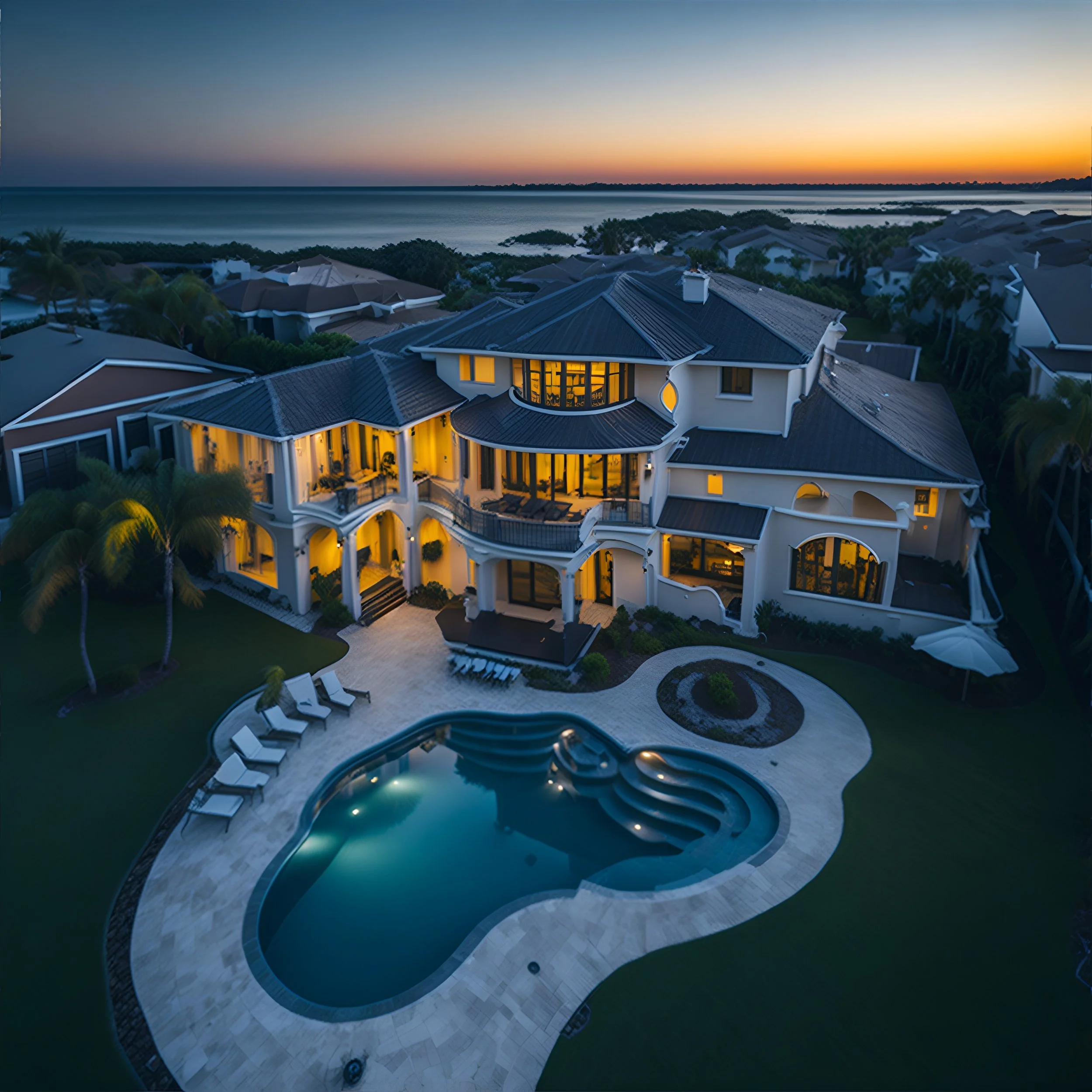
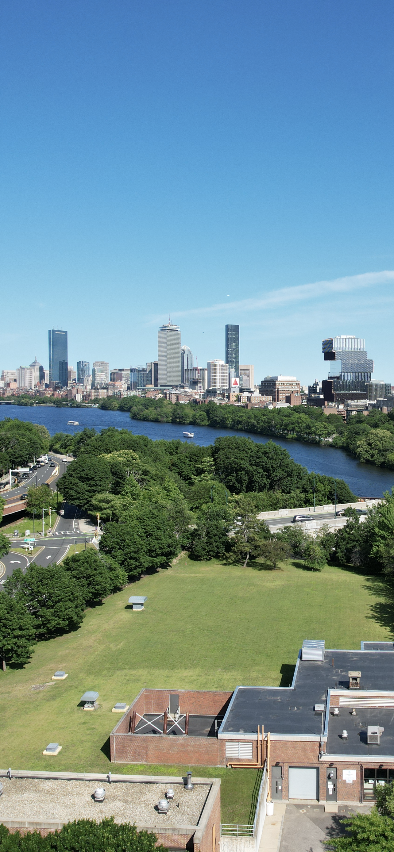
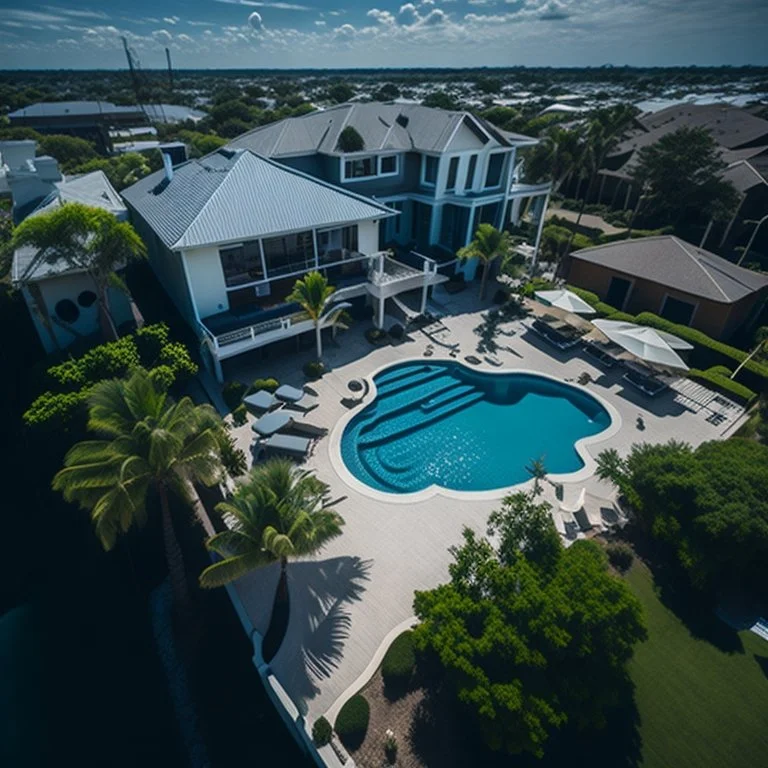
Residential and Commercial Real Estate
Real estate images taken with drones are aerial photos of properties and their features. They can showcase the property’s size, shape, location, and condition. They can also create visual intrigue and attract buyers.
-

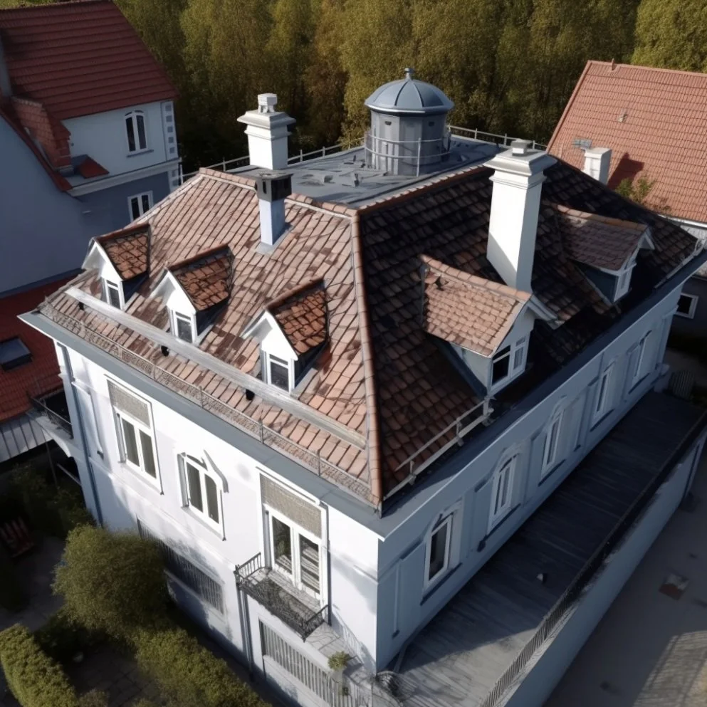
Rooftop
Rooftop inspection performed by drones is a method of using UAVs with cameras and sensors to collect images and data of rooftops. It can evaluate roof condition, spot problems or damage, and save costs, time, and risks.
-

Drone Lidar
Drone lidar is a technology that uses laser pulses to measure distances and create 3D models of the environment. Drone lidar can penetrate through vegetation and reach the ground, capturing accurate and detailed data. Drone lidar can be used for various applications, such as surveying, mapping, forestry, mining, archaeology, and emergency response.
-

Drone Photogrammetry
Drone photogrammetry is a technique that uses a drone to take many 2D photos of a geographic area and compiles them into accurate 3D models and maps with specialized software. Drone photogrammetry can be used for various applications, such as surveying, mapping, 3D modeling, and inspection
-

Solar Panels
Solar panel inspections performed by drones are a method of using UAVs with cameras and sensors to collect images and data of solar panels. They can evaluate panel condition and efficiency, spot problems or damage, and save costs, time, and risks.
-

Agriculture
Drone agriculture inspection is the use of unmanned aircraft to collect data and images of crops and fields. They can help farmers monitor crop health, estimate crop yields, optimize fertilization and irrigation, and detect pests and diseases. They can use sensors such as RGB, multispectral, thermal or LIDAR to capture data in different wavelengths and create 3D maps of the land.
-
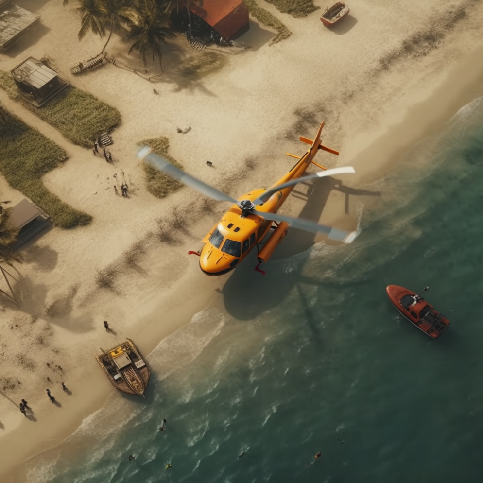
Search and Rescue
Drone search and rescue (SAR) is the use of unmanned aerial vehicles (UAVs) or drones to assist in locating and rescuing people or vessels in distress or danger. Drones can be equipped with various sensors and cameras that allow them to scan large or hard-to-reach areas, provide real-time information to first responders, and deliver supplies or lifelines to victims.
-

Drone Thermography
Drone thermography is a method of using drones equipped with thermal cameras to detect temperature differences in objects or surfaces. It is used in various industries such as construction, electrical, mining, surveillance, or inspections. In the case of solar plants, drone thermography provides a low-cost and highly accurate picture of a solar plant.
Current Services
-
Real Estate Images
We provide high quality aerial photos and videos of properties and their surroundings, which can help showcase the features and highlights of a property, such as the size, shape, location, and condition.
-
Rooftop Inspection
We evaluate roof condition, spot problems or damage, and save costs, time, and risks.
-

Construction Site
We provide updates on construction projects. We do surveying, monitoring, and inspecting work.

Services Coming Soon
-
![]()
Drone Photogrammetry
-
![]()
Drone Lidar
-
![]()
Drone thermography


Our
Team
-

Rolando Barbosa
Rolando Barbosa is the visionary founder and entrepreneur behind RB Drones. His passion for science and technology led him to pursue a degree in mathematics and engineering. Rolando is an FAA Part 107 Certified unmanned aircraft pilot, thriving on solving complex problems by utilizing drone technology and artificial intelligence (AI). Dedicated to personal growth, he constantly explores the latest advancements in tech and engages with the community to stay at the forefront of innovation.
-

Bruno Barbosa
Bruno Barbosa is the co-founder of RB Drones and a tech enthusiast who's passionate about learning new skills to self-develop and keep pace with innovation. He strongly believes that drone technology and artificial intelligence (AI) will play a key role in solving many problems we encounter today.
What Our Clients Say